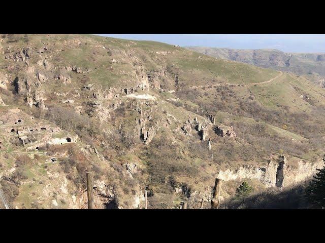
Goris a little known archaeological site
Goris a little-known archaeological site. Giant caves that resemble the underground cave cities of Cappadocia. Goris (Armenian: Գորիս) is a town and the centre of the urban community of Goris, in Syunik Province at the south of Armenia. Located in the valley of the Goris (or Vararak) River, it is 254 km from the Armenian capital Yerevan and 67 km from the provincial capital Kapan. Goris is considered one of the most important historical and cultural sites of Armenia. It is often regarded as the cultural center of Syunik. Throughout its history, Goris has been known as Kores and Gorayk. However, there are several explanations for the origin of the name. It is supposed that the name Goris is derived from the Indo-European prelanguage words "gor" (rock), "es" (to be), i.e. Goris/Kores meaning a rocky place. There was a dwelling in the ancient times in the same area of the town.
The name Goris had many variants including: Goristsa, Kores, Gores, Gorayk, Goru, and Geryusy. The area of Goris has been settled since the Stone Age.[2] Goris is likely first mentioned by name in the Urartian period. King Rusa I of Urartu, who reigned between 735 and 713 BC, left a cuneiform inscription where Guria or Goriaya is mentioned as one of the 23 countries conquered by him, which some scholars connect with Goris. During the Middle Ages, the settlement was situated in the eastern part of the present Goris, on the left bank of Goris river. It was called Kores and coincided with one of the villages of Goru and Gorayk mentioned by Stephen Orbelian in his 13th-century work History of the Province of Syunik. For some time this region was under the control of the Georgian kingdom of Queen Tamara. Between the 12th and 15th centuries, Syunik along with the rest of the historic territories of Armenia suffered from the Seljuk, Mongol, Aq Qoyunlu and Kara Koyunlu invasions. Goris is situated in the valley of Goris River, also known as Vararak River. The valley is surrounded with the Zangezur Mountains. The town has an average elevation of 1,385 metres above sea level. The surrounding mountains are famous for their medieval cave-dwellings carved out of the soft rock in the southern and eastern parts of the town. The Goris Wildlife Sanctuary is situated at the southeast of the town at a height ranging between 1400 and 2800 meters above sea level, covering an area of 18.5 km2. Caucasian grouse, roe deer and brown bear are among the notable animals in the sanctuary.
Located in a temperate and mild highland climate zone, the weather of Goris is characterized with mild snowy winters and hot summers. The average temperature in January is –1.3 °C and +19 °C in July. The annual precipitation level is between 500 and 600 mm
Тэги:
#vlad9vt #Goris #Gori #Goris_a_little_known_archaeological_site #Goris_a_little-known_archaeological_site #Urartu #Armenia #Iberian_Caucasus #Caucasus #caves #caves_city #travel_to_ArmeniaКомментарии:
ВСЕ 4 ЗЕЛЕНЫЕ МОНЕТКИ 1 НЕДЕЛЯ 14 СЕЗОН ФОРТНАЙТ
CruelShredder
Server Lenovo ThinkSystem SR650 V2 12LFF: Review
Máy Chủ Siêu Rẻ
Installinig STB Emulator pro apk
Amoya and Jevohn Kerr
Studio Spotlight: Gainax
Otaku Time
Esas Oğlan - Klip (22 Kasım’da Sadece GAİN’de!)
Beşiktaş Kültür Merkezi (BKM)
Mikheil Saakashvili - მიხეილ სააკაშვილი
Georgian Productions
ТОП 10 лучших голов ЧМ 2010 part 2 HD
FootБОЛ СПОРts
Xtreme Tactical Lasertag St. Louis, MO
Xtreme Tactical Lasertag


