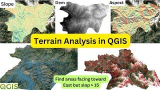
Terrain Analysis in QGIS: Slope and Aspect Analysis
Unlock the power of terrain analysis with our comprehensive QGIS tutorial! In this step-by-step guide, we will explore how to utilize Digital Elevation Models (DEMs) to analyze terrain features such as elevation, slope, and aspect. Whether you are a beginner or looking to enhance your GIS skills, this video will walk you through the essential tools and techniques in QGIS to effectively conduct terrain analysis. You'll learn: - How to import and visualize elevation data in QGIS. - Techniques for calculating slope and understanding its significance in terrain analysis. - Methods for determining aspect and its implications on land use and vegetation. - Tips and tricks for optimizing your analysis workflow in QGIS. Join us as we delve into the world of geospatial analysis and empower yourself with the skills to interpret and visualize terrain data effectively. Don't forget to subscribe for more tutorials on QGIS and spatial analysis!
In this tutorial, learn how to perform terrain analysis in QGIS using Digital Elevation Models (DEMs). We focus on two essential aspects of terrain analysis: slope and aspect. Whether you're a GIS beginner or looking to enhance your skills, this video will guide you step-by-step through calculating slope and aspect from DEM data, visualizing results, and analyzing terrain conditions.
What You'll Learn:
How to import and process DEM files in QGIS.
Calculate and visualize slope to understand the steepness of terrain.
Perform aspect analysis to determine the direction that slopes face (e.g., north, south, east, west).
Identify and map areas with slopes less than 5 degrees facing specific directions (e.g., east-facing slopes).
Understand the practical applications of slope and aspect in environmental planning, agriculture, and land management.
This QGIS terrain analysis tutorial is perfect for students, researchers, and professionals working in geography, landscape analysis, and GIS. You’ll gain insights into how slope and aspect impact factors such as sunlight, vegetation growth, and land use.
#QGIS #qgistutorial #qgismapping #TerrainAnalysis #DigitalElevationModel #Slope #Aspect #GIS #GeospatialAnalysis #QGISTutorials #Mapping
Тэги:
#terrain_analysis_in_qgis #terrain_analysis_qgis #aspect_in_qgis #aspect_analysis_in_qgis #slope_analysis_in_qgis #aspect_and_slope_in_qgis #raster_terrain_analysis_in_qgis #terrain_analysis_using_dem #slope_analysis_qgis #slope_and_aspect #aspect_analysis_qgis #terrain_analysis_(slope #Terrain_analysis_in_QGIS #qgis_terrain_analysis #terrain_analysis_aspect #Terrain_Analysis_in_QGIS #Slope_and_Aspect_Analysis #Terrain_Analysis_in_QGIS:_Slope_and_Aspect_AnalysisКомментарии:
Terrain Analysis in QGIS: Slope and Aspect Analysis
GIS with Raja Usama
cewe cantik ngajak wikwik di kelas
mumin taskirah
Zwischen Liebe & Trennung | (T)Rimworld
Bonjwa Gaming
СУПЕР Multiverse Никита Пресняков шоу Главная сцена
Dana Shelest
Галюк Екатерина Владимировна
mydocclinic
Перевязка. Видео операции - https://youtu.be/YF1TJqpzjGI
DoctorElshanskiy
Как отличать импульсы от коррекций и разворотов рынка - Урок 2
Мастер Тех.Анализа\ Структура рынка \ RevolutionFX


