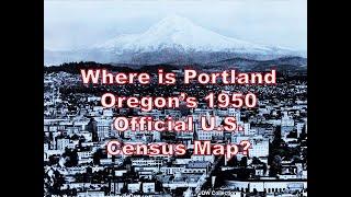
Where is Portland Oregon's 1950 Official U.S. Census Map?
Portland Oregon's 1950 Enumeration District map, as well as ED maps for the large cities of Jersey City NJ, Worcester MA, New Haven CT, and Charleston SC, are missing from the National Archives catalog. In this video I explain the status of the original Portland ED map, where to find a 1970 photostatic copy of that map, and the use of ED descriptions and 1950 Housing Block maps, to create an online map for that urban area. All the eventual tools for Portland and the other large cities that were missing their ED maps, are on the Steve Morse One-Step website (stevemorse.org, the US Census section, the Unified Tool). Good luck when the 1950 census becomes public in April of 2022. A preliminary name index will be available with the rollout, but you will find that locational tools will always be necessary for a full search strategy.
Комментарии:
МУЖЧИНА СКОРПИОН и какая женщина ему подходит.
Marina Krylova
Натворилось... Навышивалось... Накупилось...
Наталья Уютное творчество
Mongraal On Becoming A Professional Gamer At 13 | GaryVee Audio Experience w/ Mongraal
GaryVee Video Experience
Очень Жуткая Атмосфера в музыке! Не слушать на ночь! Я предупредил
ЦИФЕI Музыкальная Империя
A sexy-modern home with over 17,000 SF of lavish space in Saint Louis asking for $8,999,000
Luxury Houses - American Homes
Камень или песок. Виктор Ларионов 8 мая 2016г
Церква -Нове життя- м.Київ


